
All peer-reviewed publications

Conversational Interfaces Reshape What People Ask of Place
[Chatbot users' most distinctively conversational geospatial behaviour is asking the system to write place-grounded text and plan trips, not to retrieve facts.]

Place Distortion Begins in the Prompt
[The kind of place-writing people ask chatbots for (e.g. joke, review, report about a place) relates to whether the result idealises, stigmatises, or stays neutral; bias starts with the request, not just the answer.]
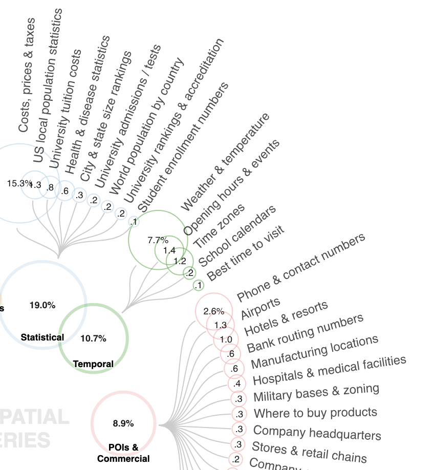
Much of Geospatial Web Search Is Beyond Traditional GIS
[People ask the web about place far more than we thought, and most of it is practical lookups (costs, hours, contact details, weather, etc.) that GIS isn't traditionally built to answer.]
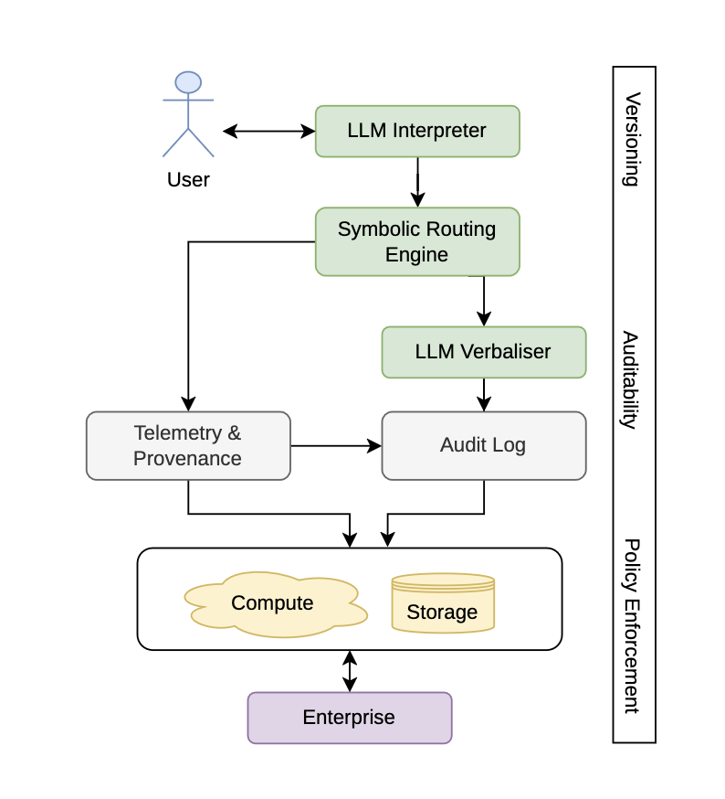
The Scenic Route to Deception: Dark Patterns and Explainability Pitfalls in Conversational Navigation
[Conversational navigation risks turning routing from a verifiable geometric task into opaque persuasion; a neuro-symbolic architecture grounding LLM outputs in pathfinding algorithms offers a path to trustworthy, explainable pedestrian navigation.]

Should We Ask an LLM? Evaluating Toponym Disambiguation across Administrative Levels
[AI models get worse at pinpointing exactly which real place a name refers to as you ask for more precise detail.]

The Potential of Grounded Synthetic Corpora to Address Persistent Geoparsing Challenges
[LLM-generated corpora grounded in gazetteers and Wikipedia can scale up geoparsing benchmarks across places and languages.]
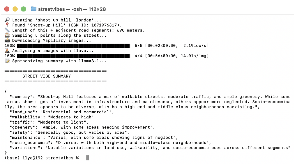
StreetVibes: An Open, Modular Pipeline for Reproducible Street-Level Urban Perception Analysis
[A privacy-preserving, open-source tool that converts street-level imagery into semantic urban indicators by orchestrating OSM, Mapillary, and local vision-language models.]
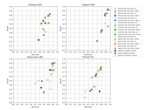
Multilingual Synthetic Corpora for Geoparsing Using Large Language Models
[Using LLMs to generate synthetic geoparsing corpora across four languages and regions, exposing systematic limitations in low-resource settings tied to geographic data coverage and linguistic variation.]
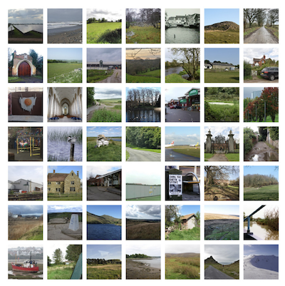
CLIP the Landscape: Automated Tagging of Crowdsourced Landscape Images
[What you see isn't always what gets tagged. A CLIP-based classifier combining image, location, and title embeddings to predict geographic context tags from landscape photos, improving spatial understanding in data-sparse regions.]
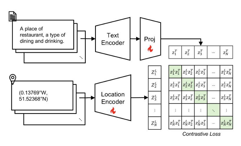
Into the Unknown: Applying Inductive Spatial-Semantic Location Embeddings for Predicting Individuals' Mobility Beyond Visited Places
[Multimodal location embeddings fusing coordinates and POI semantics via contrastive learning improve individual mobility prediction, particularly for previously unseen locations.]
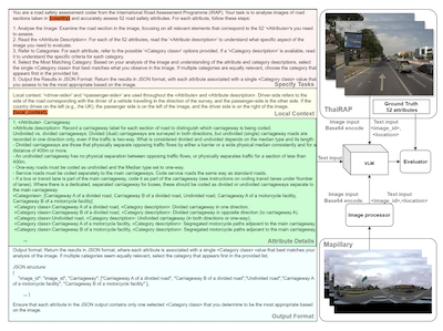
V-RoAst: Visual Road Assessment. Can VLM be a Road Safety Assessor Using the iRAP Standard?
[A zero-shot VQA framework using vision-language models to classify iRAP road safety attributes from street-level imagery, reducing the cost of infrastructure risk assessment in low-resource settings.]
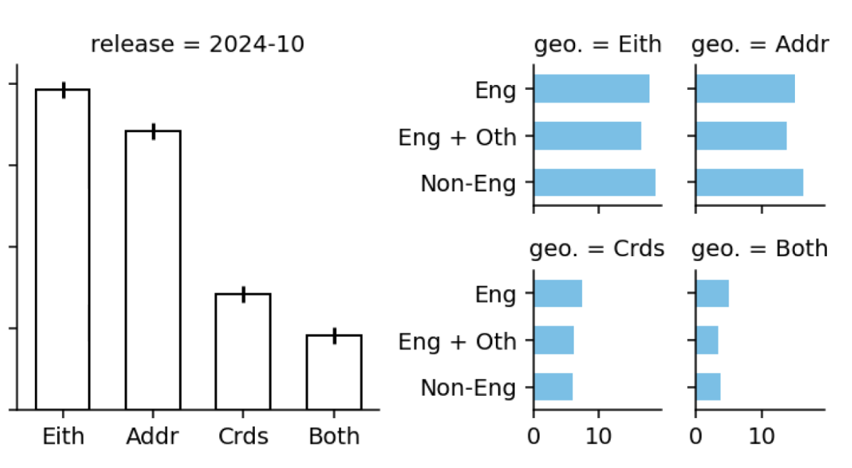
Quantifying Geospatial in the Common Crawl Corpus
[Nearly one in five Common Crawl documents contains geospatial information, offering a quantitative basis for understanding why LLMs develop spatial reasoning capabilities.]
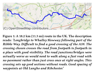
CC-GPX: Extracting High-Quality Annotated Geospatial Data from Common Crawl
[A pipeline to extract paired GPX tracks and human-written descriptions from Common Crawl, yielding a multimodal dataset of 1,416 real outdoor routes for geospatial and NLP research.]
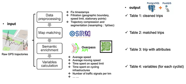
CycleTrajectory: An End-to-End Pipeline for Enriching and Analyzing GPS Trajectories to Understand Cycling Behavior and Environment
[An end-to-end pipeline that map-matches cyclists' GPS trajectories to OpenStreetMap, enriching raw data with road semantics and derived mobility metrics.]
Do Sentence Transformers Learn Quasi-Geospatial Concepts from General Text?
[Fine-tuned sentence transformers show zero-shot capacity to match hiking queries to route descriptions, hinting at untrained geospatial utility.]